 A triple dip La Niña is an extremely rare event in meteorology where La Niña conditions, in the northern half of the world, appear for three consecutive winter seasons in a row. And the end of 2022 is the first time this will happen during the current century. The World Meteorological Organization (WMO) also says this is only the third “triple dip La Niña” since 1950.
What Is the Triple Dip La Niña Forecast?
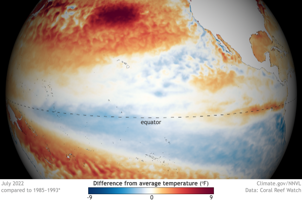
Like everything else in meteorology, supercomputers predict atmospheric conditions such as La Niña ahead of time so people around the world can plan for its impact. La Niña occurs when certain sections of Pacific Ocean waters (near the equator) are consistently cooler than normal and these conditions intensified during July and August 2022.
La Niña, like its alter ego El Niño, alters weather patterns around the world, especially during the northern hemisphere winter months of December, January and February.
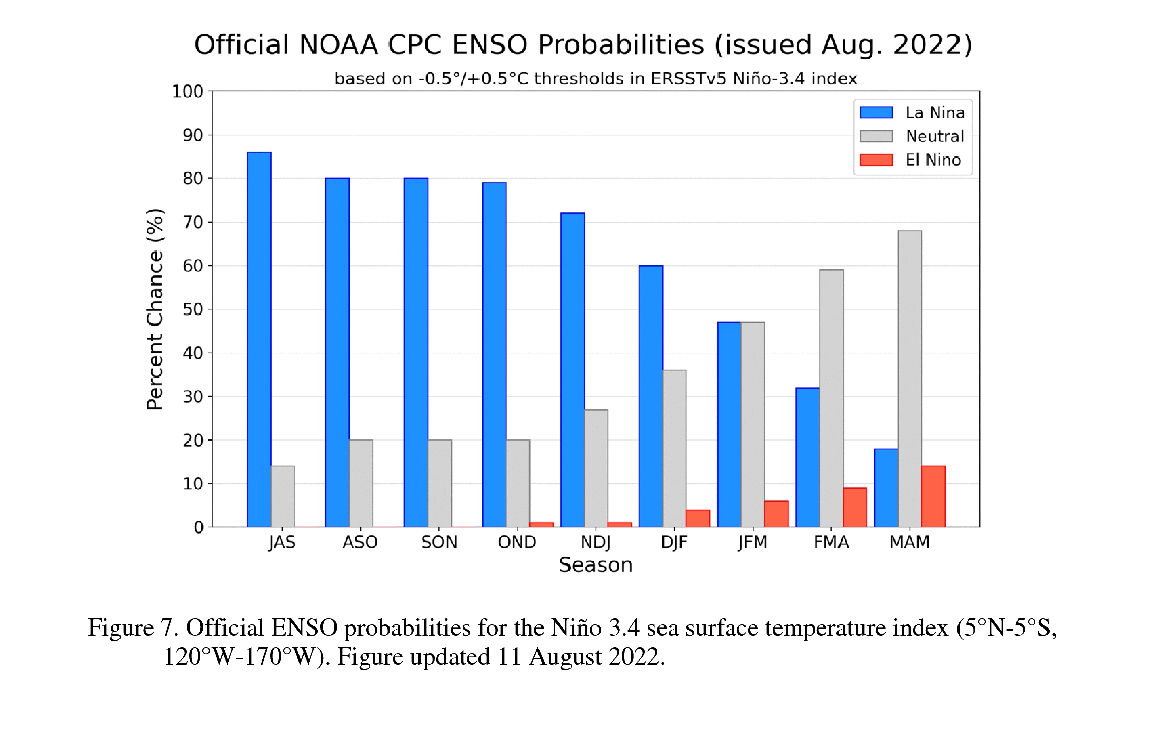
The National Oceanic and Atmospheric Administration (NOAA) predicts La Niña conditions (blue bars) into both September, October and November (SON on the chart) and continuing into winter 2022 (DJF on the chart), making it a La Niña triple dip.
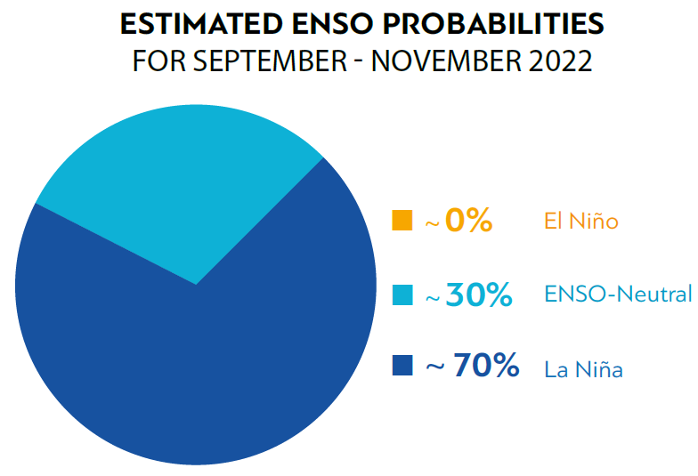
The World Meteorological Organization (WMO) also forecasts a triple dip La Niña through fall and into winter 2022-2023:
What Does a “La Niña Triple Dip” Mean For Climate?
La Niña’s key identifier is a significant area of unusually cool waters in the Pacific Ocean. A triple dip means these cooler than normal waters persisted for three years in a row.
“It is exceptional to have three consecutive years with a la Niña event. Its cooling influence is temporarily slowing the rise in global temperatures – but it will not halt or reverse the long-term warming trend,” says WMO Secretary-General Prof. Petteri Taalas.
La Niña, however, is considered the largest short-term driver of climate in the northern hemisphere. And so is the opposite condition, El Niño, which is when unusually warm waters appear in the equatorial Pacific. Both of them can shift weather patterns around the globe, depending on how long they last and how strong they are — that is — how much warmer or cooler than normal are those waters in the Pacific Ocean? Collectively, they are called the El Niño La Niña Southern Oscillation and the Pacific ping-pongs back and forth between these extremes every few years. But not right now.
What Does La Niña Mean for Winter Weather?
Every time these conditions spread like wildfire across news websites and on social media, people wonder: how will La Niña change my winter weather? Will it mean more sun, more snow or more rain? The answer to that question is “yes” but which of those happen at your place likely depends on where you live in North America or the rest of world.
The World Meteorological Organization put together a great FAQ on La Niña and El Niño that includes maps showing who gets wet and who goes dry during these events, which as I mentioned, are powerful drivers of short-term climate and the weather that we experience.
Read the El Niño and La Niña Frequently Asked Questions
And the NOAA put together a great site for those in the United States:
Winter Impacts on the United States for Every La Niña and El Niño Since 1950
Conclusion
A rare La Niña triple dip is the most likely scenario for winter 2022-2023, as the La Niña that first appeared in 2020 behaves like the “Energizer bunny” because it keeps going, and going, and going.
Leave a Reply