Bruce Sussman · Portland Weather

Portland Oregon Weather Blog | Emmy Award Winning TV News AMS Meteorologist

Connect with me!

  • Facebook
  • Instagram
  • LinkedIn
  • Twitter
  • YouTube
  • Home
  • Biography
  • Demo Videos
  • Wx Graphics
  • Community
  • School Visits
  • Weather Fun
  • Contact Bruce

Bruce Sussman, Meteorologist
Demo Reel | Weather Graphics
Resume & Experience

Subscribe to Blog Posts

Sign up to have the latest blog posts emailed directly to you!

Facebook Weather Page

Latest Tweets

Tweets by @forecastupdates

Portland Weather

Forecast Radar Cameras Photos
WeatherBug WeatherBug
Your weather just got better.

Categories

  • Climate Patterns
  • Earthquakes / Volcanoes
  • Extreme Weather
  • Heavy Rain / Flooding
  • Interviews
  • National Weather
  • Portland Weather
  • School Visits
  • Weather History
  • Weather Photos
  • Weather Research & Technology

Web Design & WordPress

Need help setting up a website?
Contact Kelli Sussman at
Consistent Image Web Design in Portland Oregon. She specializes in WordPress website design.

More Rain Friday Than All The Rest Of February

February 22, 2013 by Bruce Sussman 6 Comments

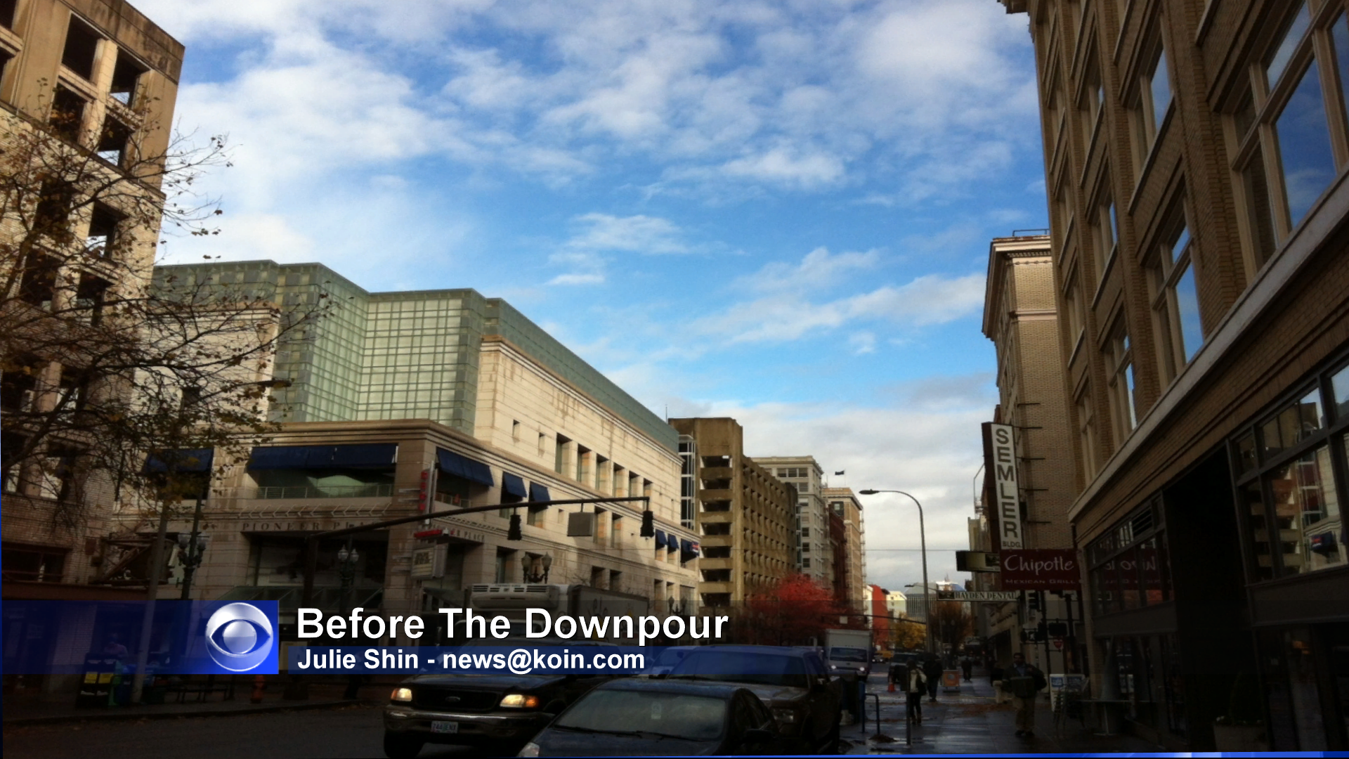
It's true. So far in February 2013 here in Portland we've barely topped .25" of rain. Today alone we're looking at .40" to .75" in the Willamette Valley. So it's going to seem wet, for sure! The moderate to heavy rain moves out by late afternoon leaving us in shower and sun breaks mode. The … [Read more...]

Filed Under: Extreme Weather Tagged With: mt hood snow, portland february storm

First EF-4 Tornado Of 2013 Touches Down In The Southern U.S.

February 11, 2013 by Bruce Sussman Leave a Comment

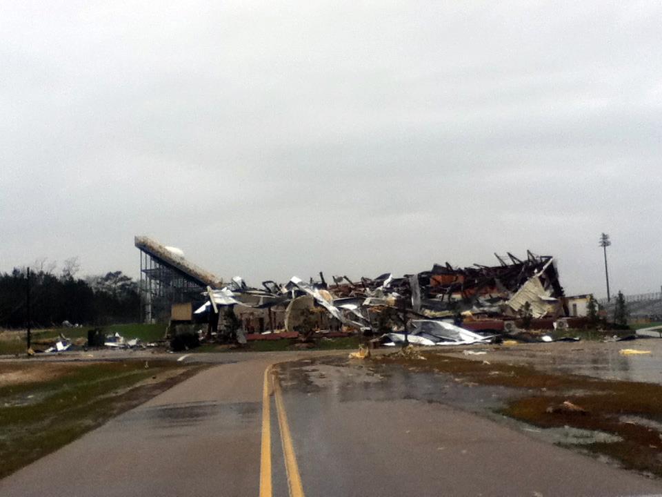
Do you recognize what this is? I certainly did not. It's a home in Mississippi that was hit by a massive and powerful tornado with 170mph winds. A man named Bruce Gilstrap and his wife drove past this house minutes after the tornado hit. Here's his story from the facebook page of the … [Read more...]

Filed Under: Extreme Weather Tagged With: first ef4 tornado 2013, hattiesburg ms tornado damge picture, mississippi tornado, mississippi tornado damage photos, oak grove high school tornado damage

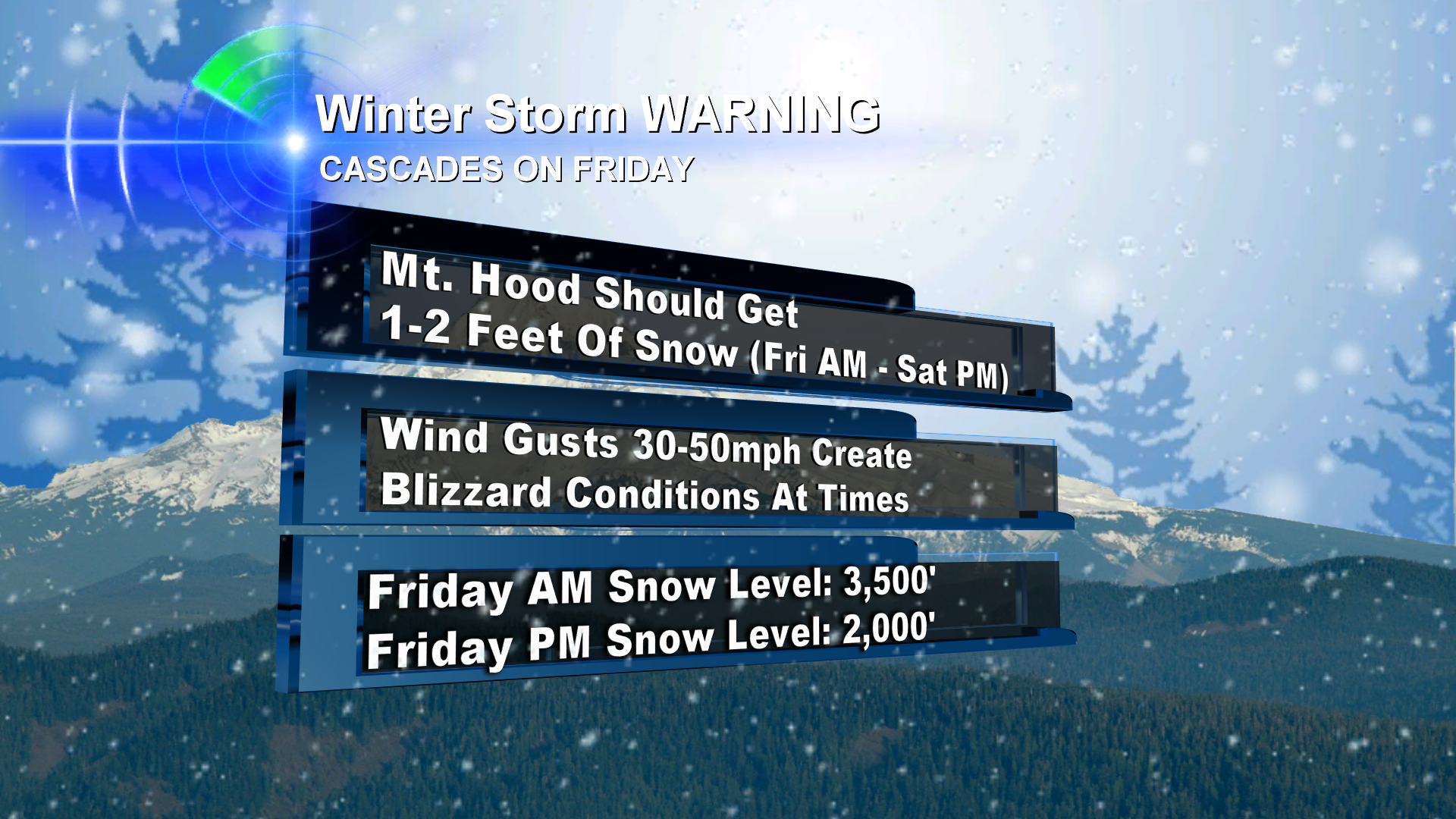
Two Chances For Willamette Valley Snow, Gusty Winds Possibly ‘A Go’

December 14, 2012 by Bruce Sussman 1 Comment

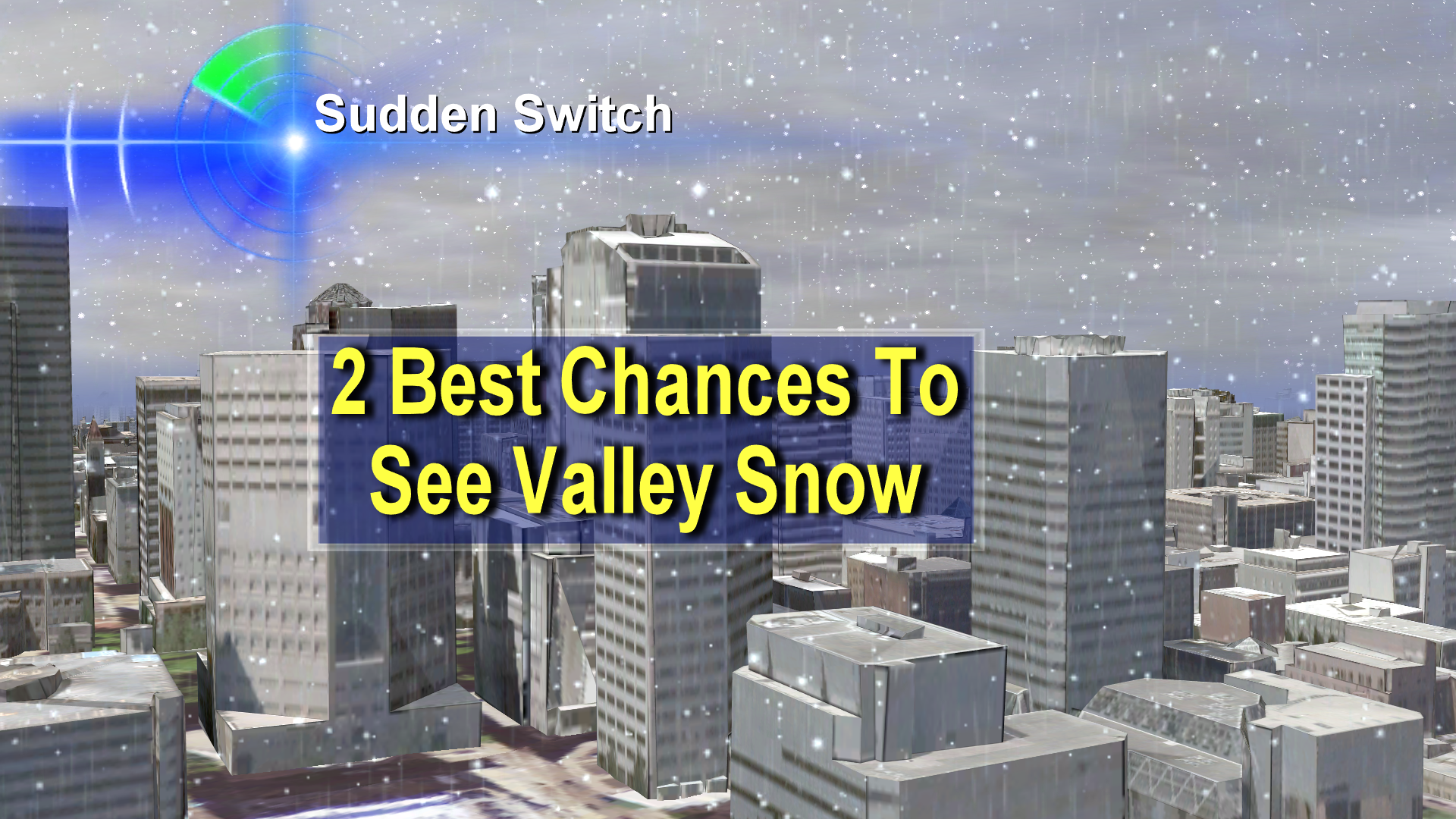
Here it comes: many of us are about to see our first snow of the season! In fact, it looks like we have not one, but two really good chances to see snow in the next week. Saturday Forecast - Both Rainy & Snowy For Many Of Us This graphic from my Friday evening newscasts explains what … [Read more...]

Filed Under: Extreme Weather Tagged With: chances for snow and wind, portland gusty winds, portland oregon snow, portland vancouver snow, portland weekend snow, portland winter weather

Intense Downpours Rip Across Portland Metro Area

November 20, 2012 by Bruce Sussman 2 Comments

While PGE crews worked around the clock in Oregon City to restore power to thousands of customers still powerless after Monday's powerful storm, more intense downpours hit the Portland - Vancouver metro area with 40mph gusts, rain and hail. It's days like these where I just love our 3-D Doppler … [Read more...]

Filed Under: Extreme Weather Tagged With: 3d doppler, pge oregon city crews, portland deluge video, portland downpour, portland hail, portland storm november, portland wind rain hail

Funnel Cloud, Heavy Hail Hit Oregon Coast & Willamette Valley

November 10, 2012 by Bruce Sussman 1 Comment

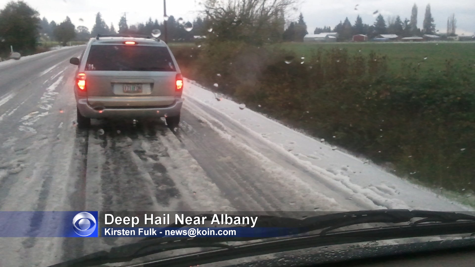
They caught more than fish, Friday, on board the boat called the "Ruby Sea" . They also caught this photo taken from the Columbia River of a thunderstorm that created a funnel cloud. This funnel cloud was over land and also reported by a number of eye witnesses in the Costco parking lot in … [Read more...]

Filed Under: Extreme Weather Tagged With: albany hail, astoria funnel cloud, funnel cloud astoria, funnel cloud columbia river, funnel cloud fishing boat ruby sea, funnel cloud hammond, highway 20 hail, newport hail, oregon coast thunderstorm, seaside hail, warrenton funnel cloud

Hurricane Sandy, By The Numbers

October 30, 2012 by Bruce Sussman Leave a Comment

Flood water from Hurricane Sandy storm surge pours into a New Jersey Path (subway) station in Hoboken, NJ. It looks like something I saw just last week on the Universal Studios tour. But this is for real. And today, Tuesday October 30, 2012, is when we see much more of the damage that's been … [Read more...]

Filed Under: Extreme Weather Tagged With: flooded nj path station photo, frankenstorm, hurricane sandy, sandy storm numbers, superstorm sandy

  • « Previous Page
  • 1
  • …
  • 5
  • 6
  • 7
  • 8
  • 9
  • …
  • 19
  • Next Page »
  • Facebook
  • Instagram
  • LinkedIn
  • Twitter
  • YouTube

Weather Links

  • Bruce Sussman Facebook
  • Bruce Sussman Twitter
  • National Weather Service
  • Consistent Image Web Design - Portland
  • New Moon Aesthetics
  • Pressure Washing Company Clackamas / Happy Valley
  • Recent Posts

    • What Is a Triple Dip La Niña?
    • Portland 2020 Weather ‘Year In Review’
    • How Long Will Portland Have World’s Worst Air Quality?
    • Save The Date — 27th Annual Winter Weather Forecast Conference
    • Earthquake Outlook For Western Oregon and SW Washington

    RETURN TO TOP
    © 2026 Bruce Sussman · Portland Weather · Contact Us · Site Map · Google+
    Consistent Image Web Design - Portland Oregon | WordPress Websites Portland